Automated 3D Facility Mapping
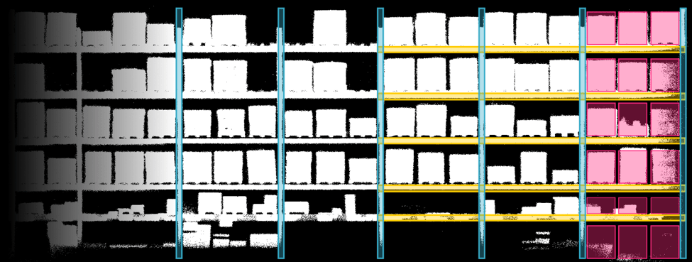
Implementing Verity’s self-flying inventory drones in warehouses of any size requires an accurate mapping of every slot in the warehouse. This mapping enables the drones to understand where to fly and what to scan, and to accurately compare the data they capture with the corresponding data in the WMS. Using that information, Verity identifies discrepancies and delivers actionable insights directly to the Verity Dashboard to enable immediate resolution. Automated 3D Facility Mapping facilitates this process by ensuring every position is recorded with precision.
To construct a precise digital model of the complete racking environment, the cameras on the inventory drones are used to extract the physical dimensions of the racking. Once these basic dimensions are established, the drones navigate through the warehouse to capture images of the face of the racking, measure the height of each horizontal beam, and map each rack location. The result is a highly accurate 3D representation of the entire warehouse—including every available inventory slot.

The advantages of automated 3D Facility Mapping include:
- Less time on site to implement the Verity system.
Using 3D Facility Mapping, our team can map the warehouse in days instead of weeks, shrinking the deployment time for the system to as little as one week. - Greater accuracy for inventory management.
One source of errors in many WMS systems is an inaccurate representation of the warehouse. This can cause the WMS to list locations that do not exist, indicate an incorrect number of horizontal beams, or include inaccurate slot labels. Based on the accurate 3D map created with the mapping tool, each slot is named and assigned in WMS—a process that often reveals errors in the WMS which can then be addressed to improve overall accuracy. Using the updated and highly precise 3D model, the drones are able to capture data at the right location every time. - Easier system updates when warehouse configurations change.
When the racking in the warehouse is moved, extended, or altered to support the changing needs of the business, a convenient way to update the 3D model of the rack is needed. Automated 3D Facility Mapping can be used to add areas to the existing model or, if needed, to rapidly re-map the entire warehouse.
At Verity, our goal is to help every client achieve a zero-error warehouse as quickly and efficiently as possible. Automated 3D Facility Mapping supports this goal—beginning with one of the first and most important steps in the implementation process.
Use the button below to learn more about how Verity delivers a zero-error warehouse.